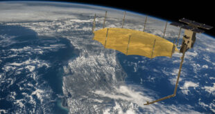
Capella Space - an American-based company providing data and satellite solutions for government and commercial use - announced on the 22nd of February that it will launch its Analytics Partner Program. This program aims to meet the increasing global demand for geospatial products and solutions that leverage the power of Synthetic Aperture Radar (SAR) imagery. This program will empower partners to develop AI-powered geospatial solutions for a wide range of industry verticals.
Read More »Rocket Lab successfully deploys second satellite for Synspective
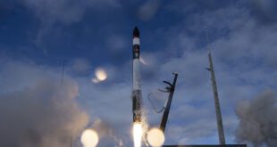
Rocket Lab has successfully deployed a second Synthetic Aperture Radar (SAR) satellite to orbit for data and solutions provider Synspective, bringing the total number of satellites deployed by the company to 110, Rocket Lab said. Electron successfully deployed the StriX-β spacecraft, adding a second satellite to Synspective’s SAR constellation.
Read More »Iceye raises US $136 million in funding round
SAR data provider and expert in NatCat solutions, Iceye, announced the closing of a US $136 million series D funding round, led by investor Seraphim Space. New strategic investors include BAE Systems and Kajima Ventures among others. Molten Ventures, Services Group of America, Space Capital, Promus Ventures and many more have also participated in the funding round.
Read More »Mayday.ai to enhance disaster monitoring with L3Harris Geospatial
Real-time risk and disaster intelligence provider, Mayday.ai, covering multiple disasters and all geographic regions, is leveraging L3Harris Geospatial’s technology to boost its disaster monitoring capabilities, the companies announced. ENVI and ENVI SARscape, developed by L3Harris and sarmap SA, will grant Mayday.ai access to spectral high-resolution imagery.
Read More »Iceye participates in commercial radar evaluation
Iceye signed a contract in the U.S. with the National Reconnaissance Office (NRO) to participate in the evaluation of commercial remote sensing companies operating synthetic aperture radar (SAR) satellites, the company said. It will focus on modeling and simulation and also support NRO’s detailed assessment of imaging modes, image quality, geolocation accuracy and coverage.
Read More »Rocket Lab Successfully Deploys Capella’s SAR Satellite on 14th Mission
Rocket Lab, a space systems company and the global leader in dedicated small satellite launch, has successfully launched its 14th Electron mission and deployed a single microsatellite for Capella Space.
Read More »PredaSAR completes Critical Design Review to begin largest SAR satellite constellation
PredaSAR Corporation has successfully completed its Critical Design Review (CDR) to begin fabrication, testing and launch of its Synthetic Aperture Radar (SAR) spacecraft, in partnership with Tyvak Nano-Satellite Systems Inc.
Read More »SpaceX to Launch PredaSAR’s First Satellite
PredaSAR Corporation, announced on 4 August 2020 that its first of 48 advanced commercial Synthetic Aperture Radar (SAR) satellites will launch on SpaceX’s Falcon 9 launch vehicle. Tyvak Nano-Satellite Systems, Inc. is the launch integration provider in addition to manufacturer of the spacecraft
Read More »ICEYE SAR satellite imagery available through ESA’s Earthnet
ICEYE, Finnish New Space and global leader in small satellite synthetic-aperture radar (SAR) technology, is providing its SAR satellite data for assessment via ESA’s Earthnet Third Party Mission (TPM). Through this programme, ESA sponsors the cost to access ICEYE’s SAR data for research and Earth Observation (EO) based application development.
Read More »Capella uses space to bring you closer to Earth
Capella Space, a provider of on-demand Earth observation (EO) data via synthetic aperture radar (SAR), is going all-in on AWS. Capella runs its entire IT infrastructure on AWS to automate and scale its operations.
Read More » SpaceWatch.Global An independent perspective on space


