Viktoria Urban
November 18, 2021
Europe, Frontiers News, Middle East, News, Region, Space, Space Economy News, Space for Earth News
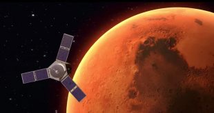
ICEYE announced having signed a Memorandum of Understanding (MoU) to collaborate on developing advanced SAR products. The collaboration builds on G42’s recent agreement with Yahsat to develop a geospatial data fusion of different sensor modalities.
Finnish Synthetic-Aperture Radar (SAR) satellite and analytics provider, ICEYE
Read More »
Viktoria Urban
November 5, 2021
Frontiers News, Middle East, News, Region, Space, Space Economy News, Space for Earth News
Yahsat Government Solutions and G42 Space Program want to work together to deliver AI-enabled remote sensing services to customers, G42 announced. Under the agreement, satellite company Yahsat will make use of G42’s artificial intelligence, cloud computing and analytics capabilities.
Read More »
Melissa Maday
May 5, 2020
Asia Pacific, Features, Region, Space, Space Economy News, Space for Earth News, SpaceWatch.Global Opinion
By Alessandra Albano The global space industry is expected to generate revenue of US$1.1 trillion or more in 2040, up from the current US$350 billion, according to Morgan Stanley. Investors are also taking an upbeat view of the prospect of investing in space innovations amidst the risk of technical recession. According …
Read More »
Melissa Maday
April 20, 2020
Europe, News, Region, Space, Space Economy News, Space for Earth News
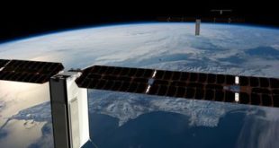
Spire Global, a global data service provider and leader in AIS data solutions and weather forecasting, and VesselBot, a leading AI and Big Data technology company with deep shipping domain expertise, announced a new partnership to co-develop AI-enabled digital products for the maritime industry.
Read More »
John Sheldon
November 19, 2019
Frontiers News, Geopolitics News, Middle East, News, Region, Space, Space Economy News
Mubadala Investment Company, the Abu Dhabi-based global investor, will showcase the latest development across its diverse aerospace portfolio at Dubai Airshow 2019, which runs from 17-21 November 2019.
Read More »
John Sheldon
September 16, 2019
Asia Pacific, News, Region, Space, Space Economy News, Space for Earth News
Satellogic, the world’s first vertically integrated geospatial analytics company, has announced that they have partnered with ABDAS, based in Henan Province, China, to deliver exclusive access to a dedicated constellation of satellites.
Read More »
Helen Jameson
August 16, 2019
Asia Pacific, News, Region, Space, Space Economy News, Space for Earth News
Luokung Technology has announced a strategic cooperation agreement to provide cloud services based on image data from remote sensing satellites to manage data unification for the China Centre for Resources Satellite Data and Application with the aim of achieving more reliable, safer and efficient data cloud services.
Read More »
John Sheldon
May 10, 2019
Asia Pacific, News, Region, Space, Space Economy News
Sky and Space Global Ltd. (SAS) has announced that seven new potential revenue opportunities have been put in place since the Company announced, on 9 April 2019, its plans to progress a Global Coverage constellation for the growing demand in the Internet of Things (IoT) and Machine-to-Machine (M2M) sectors.
Read More »
John Sheldon
May 6, 2019
Middle East, News, Region, Space, Space Economy News, Space for Earth News
SatSure, the Indian geospatial data analytics company that utilises advances in Earth observation satellites, machine learning, and big data analytics, has announced that it has won the Imkan Innovation Award worth U.S.$10,000 at startAD’s Venture Launchpad.
Read More »
Helen Jameson
March 27, 2019
Europe, Frontiers News, News, Region, Space, Space Economy News, Space for Earth News
Spacebel and Wuudis Solutions (Wuudis) have signed a business agreement in Liège, Belgium on the distribution of Wuudis services to forestry users of the EO Regions! business platform and the commercialisation of Spacebel’s earth observation (EO) forest products on the Wuudis electronic platform. The aim is to strengthen their common offer in the field of forestry services worldwide.
Read More »
 SpaceWatch.Global An independent perspective on space