SpaceWatch.Global An independent perspective on space

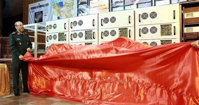
Iran’s defence minister, Brigadier General Hossein Dehghan, has claimed that Iran has created a Local Positioning System (LPS) making Iran independent from any reliance on the US Global Positioning System (GPS).
Brigadier General Dehghan told Iranian journalists that LPS consists of five high-powered transmitters located around Iran that can provide positioning, navigation, and timing (PNT) signals that are more accurate than directly accessing the signals from GPS satellites.
The reality is that LPS, while certainly more accurate than GPS satellite signals, is dependent on access to GPS and other space-based global navigation satellite systems (GNSS) in order for it to function. In fact, what the Iranian government refers to as LPS is better known as Differential GPS and is a technique that has been around for several decades and used around the world.
Differential GPS uses a network of fixed, ground-based reference stations to broadcast the difference between the positions indicated by the GPS satellite systems and the known fixed positions. These stations broadcast the difference between the measured satellite pseudoranges and the actual, internally computed, pseudoranges, and receiver stations may correct their pseudoranges by the same amount. The digital correction signal is typically broadcast locally over ground-based transmitters of shorter range.
A pseudorange is the distance between a satellite and the GPS receiver at the known, fixed location.
In the case of Iran the five high-powered transmitters mentioned by Brigadier General Dehghan will broadcast the difference between the positions indicated by GPS satellites and the known, fixed position in Iran.
By using Differential GPS Iran can exponentially improve the accuracy of GPS and other GNSS providers, but it cannot shake off its reliance on GPS altogether as Brigadier General Dehghan claims.
Even if Iran uses another GNSS provider for the signal used at its fixed, known locations – such as Russia’s GLONASS or Europe’s Galileo – it is still indirectly reliant upon the US GPS constellation since Russian, European, Chinese, and Indian GNSS services in turn rely on GPS for the accuracy and reliability of their own satellite navigation systems.
Iran’s LPS may well be fodder for Iranian propaganda but in reality it cannot avoid using GPS so long as it requires accurate and reliable positioning, navigation, and timing services.