SpaceWatch.Global An independent perspective on space

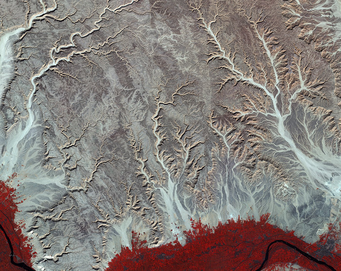
Readers around the world are afforded a view over central-eastern Egypt by the Sentinel-2A satellite. Sitting between the Nile River and the Red Sea, the landscape captured in the image is of the arid Eastern Desert, punctuated by water erosion from rivers and streams that makes the distinctive pattern.
The vivid red, which is due to the false-colour image being processed to include near-infrared, is actually fields of farmlands situated along the Nile. As the chlorophyll content differs within each crop, the shade of red varies, indicating how sensitive the multispectral instrument on Sentinel-2 is. This ability to depict varying shades enables the satellite to provide key data on the health and development of the planet’s flora – and that’s far out!